
Dateline: September 13, 2025 — As the climatological peak of the Atlantic hurricane season arrives, scientists, forecasters, and coastal communities are asking the same question: where are the tropical storms? The Atlantic basin has been unusually muted this year so far, but forecasters warn the lull can end quickly — and when it does, tropical storms Atlantic could return with force.

Brief status check: current activity and official outlook (Tropical Storms in the Atlantic)
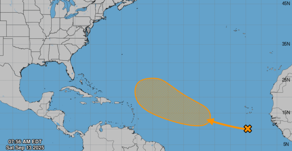
Right now, there are no major, long-lived hurricanes in the North Atlantic, and the National Hurricane Center’s running summary shows fewer named storms and hurricanes than long-term averages as of September 13, 2025.
NOAA and other agencies continue to forecast an above-normal 2025 season for the Atlantic, predicting between roughly 13 and 19 named storms and several hurricanes before the season ends on November 30. That official outlook remains the backdrop for the current quiet — it says a busy season is still possible.
Why the quiet? Atmospheric factors keep tropical storms in the Atlantic suppressed
Meteorologists point to a mix of atmospheric forces that have kept tropical storms’ Atlantic formation below expectations this year. Dry, dusty air blown off the Sahara has been widespread across the tropical Atlantic, stabilizing the lower atmosphere and making it harder for organized convection to take hold. At the same time, a subdued temperature gradient between the tropics and subtropics has reduced the atmospheric instability that fuels storm development.
Climate drivers like the Madden–Julian Oscillation (MJO) and evolving El Niño–Southern Oscillation (ENSO) conditions also play a role. Forecasters note that a shift in the MJO or a move toward La Niña conditions later this fall could create a more conducive environment, allowing tropical storms in the Atlantic to form more readily.
Recent named systems and what they taught forecasters
The 2025 season has produced several notable systems earlier in the year. Hurricane Erin — the season’s first major hurricane — brought a reminder that a single storm can cause outsized impacts even in an otherwise quiet period. Erin intensified rapidly in August and prompted warnings along parts of the Caribbean and U.S. East Coast.
More recently, storms in other basins served as a reminder that tropical cyclones remain an active global threat. For example, remnants and weakening systems tracked near Mexico and the Pacific highlighted how storms can shift basins or decay while still producing heavy rain. These events show how forecasts and warnings must remain nimble as conditions change.
What forecasters now expect for late September and October
Several forecasting centers — including academic groups and government agencies — are watching the western African troughs and tropical waves that traditionally seed Atlantic storms. Colorado State University scientists and other forecasters have signaled that the latter half of September may bring renewed activity, potentially increasing the number of tropical storms in the Atlantic before autumn progresses.
NOAA’s seasonal outlook and monitoring products stress that probabilities remain elevated for additional named storms through November. Forecasters emphasize that a lull is not the same as safety: even a late-season uptick can produce rapid intensification and dangerous impacts for coastal communities.
Coastal preparations and public response
Emergency managers along the U.S. Gulf and East Coasts, and in Caribbean nations, say they are using the quiet period to check supplies, update evacuation plans, and shore up communication networks. Authorities and preparedness groups note that complacency is the biggest risk during a lull; an unexpected storm can expose weaknesses in readiness if communities delay preparation.
Public reaction on social platforms shows a mix of relief and anxiety: some users cheer the calm, while others warn of “the storm that makes up for lost time” — a sentiment echoed by meteorologists who caution that energy saved by a quiet summer can fuel intense late-season systems.
Platform X and social reactions: how people are talking about tropical storms in the Atlantic
On Platform X (formerly Twitter), meteorologists, storm chasers, and weather hobbyists have been highly active. Accounts such as TropicalTidbits and forecasters like Ryan Maue are posting frequent updates and model guidance, noting the lull but tracking emerging waves off Africa that could become the next named systems. These posts blend technical model snapshots with plain-language takes meant for general audiences.
Alongside experts, local news outlets, and residents have used X to share preparedness tips, imagery of past storm damage, and real-time observations. Hashtags tied to tropical storms in the Atlantic have been used both to aggregate official advisories and to circulate viral — and sometimes misleading — claims, prompting fact-checks from meteorological organizations.
Risks to watch: flooding, storm surge, and rapid intensification
Forecasters warn that even weaker tropical storms in the Atlantic can produce catastrophic rainfall and life-threatening flash floods, especially in mountainous islands and coastal floodplains. Rapid intensification — when a storm’s wind speeds climb dramatically in a short period — remains a major forecasting challenge and a primary driver of surprises that strain emergency response.
Insurance companies and emergency planners are also watching accumulated cyclone energy (ACE) and sea surface temperature anomalies, which influence both the number and intensity of storms. While ACE has lagged this year relative to long-term norms, record-warm ocean patches mean the potential energy for strong storms remains non-trivial.
What should residents do now?
Experts urge residents in hurricane-prone regions to treat forecasts seriously, even during a quiet spell. That means refreshing emergency kits, reviewing evacuation routes, checking flood insurance, and signing up for local alerts. A short preparation checklist can make a substantial difference if tropical storms in the Atlantic or hurricanes materialize with little lead time.
Looking ahead: climate context and long-term shifts
Scientists continue to study how a warming climate reshapes tropical cyclone behavior. The consensus view is that while the overall number of storms in any given year may not change dramatically, the proportion of storms that reach high intensity is likely to increase. That raises questions about coastal resilience — especially as sea-level rise compounds storm surge impacts. The quiet in 2025 does not change those broader trends.
Bottom line
As of September 13, 2025, the Atlantic basin is quieter than many expected at the peak of hurricane season, but official outlooks from NOAA and independent forecasters keep the door open for a busier late season. Tropical storms in the Atlantic remain a live risk through November, and both officials and residents should keep tracking official advisories and platform X updates from trusted meteorologists. Preparation now — during the lull — is the best hedge against a sudden turn in the tropics.
Also check:-