
Hurricane Kiko – now a powerful Category 4 storm – is tracking westward over the Pacific and headed in the general direction of Hawaii. The storm’s rapid intensification caught forecasters’ attention this week. According to the National Hurricane Center (NHC), Kiko’s maximum sustained winds briefly reached about 145 miles per hour on Wednesday. By early Thursday, however, Kiko had weakened slightly to about 125 mph (making it a strong Category 3 hurricane), as it sat roughly 1,500 miles east-southeast of the Big Island. In other words, Hawaii hurricane Kiko is currently far from land but growing in strength. Meteorologists expect Kiko to continue moving westward toward the islands through the coming week. Even if Kiko loses some punch, its size and proximity mean Hawaii will need to monitor the storm closely.
Tropical authorities emphasize that no coastal watches or warnings are in effect yet for Hawaii, but they advise residents to keep a close eye on updates. The Central Pacific Hurricane Center (based in Honolulu) and the NHC are issuing twice-daily bulletins. “Interests in the Hawaiian Islands should monitor the progress of Kiko,” the NHC cautioned. Local emergency agencies echo this: Hawaii’s Emergency Management Agency (HI-EMA) tweeted that “Hurricane Kiko is a Category 4 hurricane that is forecast to approach Hawaiʻi early next week,” while noting that “direct impacts from wind and rainfall cannot be determined yet”. In plain terms, Hawaii residents are being told to stay alert and prepare, even though Kiko is still days away.

Storm’s Status: Position, Speed and Strength
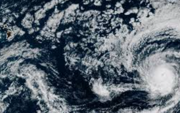
As of the latest updates, Hurricane Kiko is centered far east of Hawaii and moving steadily west. NHC advisories reported Thursday afternoon (HST) placed Kiko at about 13.9°N, 135.4°W, which is roughly 1,360 miles east-southeast of Hilo and 1,565 miles ESE of Honolulu. The storm’s forward speed is only about 9 mph to the west. These figures line up with media reports. For example, CBS News noted Kiko was “about 1,500 miles east-southwest of Hilo” on Thursday morning, with winds near 140 mph. The small differences in distance and speed are due to timing of measurements, but everyone agrees Kiko is a long way off.Figure: NOAA forecast cone for Hurricane Kiko (valid Sept 4). This graphic shows the likely track of Hurricane Kiko through next week, with the cone covering the expected path (lighter shading) and forecast positions (dots).
Despite its distance, Kiko’s classification as a major hurricane means it packs a lot of power over open water. On the Saffir-Simpson scale, Category 3 or higher is considered a “major” hurricane. Forecasters noted Kiko’s winds could fluctuate in the coming days. The NHC said the storm “weakened slightly” by Thursday evening but could strengthen again tonight and Friday before higher wind shear and cooler waters take a toll. In other words, Kiko may still reach Category 4 one more time, but that peak is likely brief. By Friday night and the weekend, models generally predict Kiko will slowly lose strength as it moves over cooler parts of the Pacific.
No direct threats to land have been reported so far. All forecasts show Kiko remains well east of Hawaii over the next few days. NHC discussion notes that, as of Thursday, “there are no coastal watches or warnings in effect” for Hawaii. Likewise, other storms are also being tracked (such as Pacific Hurricane Lorena near Mexico), but Kiko is the one being watched for Hawaii. Emergency managers in Honolulu and on the islands stress that Hawaii hurricane Kiko is far enough away that nothing needs immediate action, but preparation is wise. In HI-EMA’s words, it’s time for residents to think about how to cope without power or running water.
Projected Track Toward Hawaii
Forecast models consistently have Kiko on a west-northwestward trajectory over the next week. After crossing the International Date Line, Kiko will enter the Central Pacific basin sometime Friday night. At that point, it will fall under the purview of the Central Pacific Hurricane Center in Honolulu. In the days ahead, Kiko is expected to maintain a generally westward (sharply west-northwest) motion. Forecasters say that motion should persist through the weekend, with a slight uptick in forward speed (perhaps 10–12 mph) by early next week.
According to official advisories, Kiko’s center may come as close to the Hawaiian Islands as early to mid-next week. As of Thursday, prediction cones from NOAA forecast Kiko approaching the islands around Tuesday–Wednesday of next week. However, the cone of uncertainty is still wide. The Big Island of Hawaii currently lies within the five-day forecast cone, meaning it could see effects if the storm tracks slightly south of today’s projection. The Honolulu NWS notes this uncertainty: the track can shift, so “it is too soon to determine the exact location or magnitude of these impacts,” and Hawaii interests should continue to monitor the storm.
Several factors should weaken Kiko before it reaches Hawaii. Forecasters point out that sea surface temperatures ahead of the storm are only in the mid-70s°F, below the ~79°F threshold hurricanes like for strengthening. In addition, strong upper-level winds and dry air are expected to erode the storm’s circulation. Fox Weather summarizes it this way: “Several factors, including cool sea surface temperatures, hostile upper-level winds and dry air, will in essence act as a barrier between the hurricane and the islands, only resulting in limited impacts”. If this forecast holds, Kiko could be a much weaker system (perhaps a tropical storm) by the time it passes near Hawaii.
Even so, coastal influences and swells from Kiko could begin arriving over the weekend. The NHC specifically warns that “swells generated by Hurricane Kiko could begin reaching the Hawaiian Islands towards the end of this weekend. These swells could cause life-threatening surf and rip currents”. In practical terms, that means large waves and dangerous swimming conditions along all shores, even if the storm itself stays far offshore. Boaters and beachgoers should be especially careful; similar warnings were issued recently in the Atlantic for Hurricane Erin, and officials are cautious not to lull anyone into a false sense of security just because landfall isn’t certain yet.
Possible Impacts on Hawaii
Forecasts suggest that, if Kiko passes near Hawaii in a weakened state, the primary impacts would be rain, surf, and gusty winds – rather than catastrophic landfall forces. The earliest impacts are likely to be coastal: high surf, possible beach erosion, and rip currents. NOAA models indicate the tropical-storm-force wind field (winds of 39–73 mph) extends roughly 80 miles from Kiko’s center, while hurricane-force winds (74+ mph) extend only ~25–30 miles. This compact size means that islands would only feel the strongest winds if Kiko passes unusually close.
ABC News summarized the threat this way: “Either as a weak hurricane or tropical storm, Kiko will be near Hawaii next Tuesday and Wednesday, and the islands could expect dangerously high surf and strong wind gusts up to 70 mph on Tuesday through Thursday.”. In other words, even if Kiko has weakened to Category 1 or 2 by then, it could still drive towering waves and potent gusts. Heavy rain is also a concern. The CBS News report notes that the Honolulu forecast office is anticipating heavy rainfall leading to potential flooding when Kiko arrives. High terrain (like Maui’s Haleakalā or the Big Island’s Mauna Kea) could get especially heavy rain, raising flash flood risk in valleys and mudslides in burn scars.
On the positive side, many officials emphasize that Kiko should be much weaker upon approach. Forecasters say it will rapidly shed strength over cooler waters, so by the time it’s a few hundred miles from Hawaii it might be no more than a tropical storm. Fox Weather adds that Kiko is a fairly small cyclone, with hurricane-force winds reaching only 20–30 miles from its center and tropical-storm winds up to 80 miles. That means the odds of widespread damaging winds across an entire island are lower than if a huge storm were bearing down. Still, meteorologists remind people: “we just don’t know yet how close it will get.” As Fox puts it, Hawaii tends to be protected by geography (cool water and wind patterns), but when it happens it happens, so everyone needs to keep watching.
Government agencies are already promoting preparedness. Hawaii’s Department of Defense – which oversees emergency management – urged residents to think about long power outages now. In a recent post HI-EMA wrote: “Hurricane Kiko could bring lengthy power outages. It’s time to start thinking now about how to operate without electricity – including communicating, getting information, running medical devices, storing food and cooking.”. In other words, get your emergency kit together. The agency points people to ready.hawaii.gov for hurricane prep information. Residents familiar with past storms recall that even a glancing blow from Kiko could mean 1–2 days without utilities, so things like batteries, flashlights, non-perishable food and bottled water should be handy.
Key precautions Hawaii residents can take now include:
- Stock up on essentials: Water (one gallon per person per day), non-perishable food, medications, and first-aid supplies. Keep mobile devices charged and have battery backups or generators ready.
- Secure property: Bring outdoor furniture and planters inside; trim weak tree branches; reinforce garage doors if needed. Check that window storm shutters or plywood covers are on hand.
- Plan for evacuation or shelter: Though no evacuation orders are likely unless Kiko’s track changes dramatically, families should review their hurricane plan. Know evacuation routes on each island and have a “go bag” packed. Make sure pets are accounted for.
- Stay informed: Sign up for local alert systems and monitor official channels. Trust forecasts from the National Hurricane Center, Central Pacific Hurricane Center, and Hawaii’s National Weather Service offices. Know that bulletins will come out twice daily (morning and evening) and whenever conditions change.


Hawaii’s Hurricane History
Hawaii residents know that, historically, direct hits by strong hurricanes have been rare. This year’s Kiko is following a pattern: we often see storms approach the islands, only to turn or weaken before landfall. Data from NOAA indicate only four major hurricanes (Category 3 or higher) have ever come within 50 miles of any Hawaiian islan. (Compare that to hundreds of Atlantic hurricanes; Hawaii’s islands simply don’t get struck very often.) Most Pacific storms curve north or dissipate in the cooler waters near Hawaii’s latitude.
The past few years provide examples. In August 2021, Hurricane Linda’s remnants swept over parts of Hawaii, bringing heavy rain and waves – but by then Linda was a tropical depression, not a hurricanef. In July 2020, Hurricane Douglas came very close: it prompted watches and warnings as a Category 2 storm, yet never made landfall as it weakened right before Hawaii. Only once in recent memory did Hawaii take a full hit: Hurricane Iniki in 1992 slammed Kauai at Category 4 strength, which remains etched in local memory. Otherwise, storms tend to graze the islands.
This record suggests that Hawaii hurricane Kiko still has a significant chance of passing harmlessly to the south or north. Nonetheless, experts warn it’s unwise to assume history will repeat itself. Every storm is different, and the only way to know Kiko’s fate is to keep watching updated forecasts. As a Hawaii forecaster told CBS News: “It remains to be seen how close Kiko will get to the islands, so for now… just [keep] a close eye on the forecast.”. The community is braced but calm.
Staying Prepared and Informed
Even with uncertainty, preparation is the best defense. Officials advise Hawaii residents to act now rather than wait. HI-EMA Administrator James Barros reminded people that “Hurricane Kiko is forecast to approach Hawaiʻi early next week” and urged, as a minimum, to review hazard plans and emergency kits. This “humane” approach – recognizing anxiety but empowering action – is key. Community groups are circulating checklists and reminding vulnerable neighbors (elderly, medically dependent) to plan ahead.
As Kiko gets closer, residents should rely on official channels. The NHC and Central Pacific Hurricane Center will issue new advisories twice daily, and local TV, radio and internet media will broadcast any changes. NOAA’s Weather Radio is also a reliable source. Importantly, families should not panic over early reports. As of Thursday there were still no active watches or warnings in Hawaii – which means it’s still too early to call for evacuations. But it will change once Kiko nears; when that time comes, the rules are clear: if a hurricane or tropical storm watch is issued, that means you should finish preparations; if a warning is issued, take cover and follow evacuation orders.
In summary, Hawaii hurricane Kiko is a developing story. Forecasters use the latest data (satellite, recon flights, computer models) to update the public every few hours. Kiko’s unexpected strength has raised eyebrows, but conditions now favor some weakening. By next week, the islands could see the tail end of Kiko – mostly rain, surf, and a few gusts – or even less if it tracks well to the south. Either way, the close monitoring and preparation now reflect Hawaii’s resilient spirit. From Big Island ranchers to Honolulu families, people will ensure they’re ready for whatever Kiko brings. As always, staying vigilant, heeding official advice, and helping neighbors is the key to weathering any “Hawaii hurricane” event.