Introduction
Scientists have issued a mega tsunami warning following a new study by Virginia Tech indicating a 15 percent chance of a magnitude 8.0 or greater earthquake occurring along the Cascadia Subduction Zone (CSZ) within the next 50 years — a scenario that could trigger catastrophic consequences on the US Pacific Coast . This warning highlights the urgent need for improved evacuation strategies, early-warning systems, and infrastructure resilience among coastal communities from Northern California to southern Washington.
What Is the Cascadia Subduction Zone?
The Cascadia Subduction Zone is a convergent tectonic boundary extending about 600 miles from Northern California through Oregon and Washington, up to Vancouver Island, American Plate, storing immense stress over centuries. Unlike more active seismic regions like Japan or Chile, Cascadia has remained largely silent since its last major earthquake in 1700, which triggered a tsunami that reached Japan.
Rising Risk of a Mega Tsunami
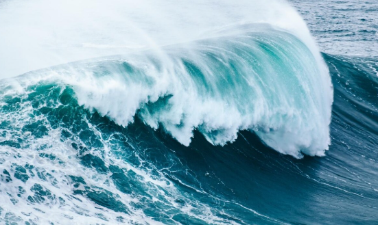
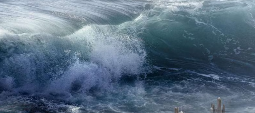
Thanks to complex computer modeling and decades of geoscience, researchers now warn that the CSZ could produce a tsunami wave up to 1,000 feet high, accompanied by sudden coastal land subsidence of up to 6.5 feet. These combined effects could expand floodplains far beyond current hazard maps, putting urban infrastructure and transportation networks in Seattle, Portland, and surrounding areas at extreme risk. The immediacy of the threat—cities potentially submerged within minutes—makes preparedness a critical priority.
Key Findings from the Virginia Tech Study
Earthquake Probability and Tsunami Magnitude
- The probability of a major earthquake (M 8.0+) in the next 50 years is estimated at 15 percent.
- Such a quake could result in a 1,000-foot tsunami and sudden coastal subsidence by up to 6.5 feet.
Geographic Focus of Impact
- Southern Washington, northern Oregon, and northern California are identified as the highest-risk zones for flooding.
- While Alaska and Hawaii face broader tsunami threats, their distance from CSZ makes them less immediately vulnerable in this scenario.
Modeling Insights
Tina Dura’s team ran tens of thousands of simulations, revealing that current hazard maps underestimate how far flooding and wave penetration could extend. In addition, a combination of sea-level rise and sudden subsidence could triple flood-prone areas—by 2100, floodplains might span up to 115 square miles.
Human and Economic Toll
- More than 30,000 lives could be lost, over 170,000 buildings destroyed, and economic damage exceeding $81 billion in coastal damage.
- Infrastructure such as highways, airports, and wastewater facilities may become unusable or submerged, leading to long recovery timelines.
Also visit:-
Historic and Geological Context
The last major earthquake in the CSZ occurred around 1700, with geologic evidence confirming at least 41 subduction earthquakes over the past 10,000 years and multiple “full margin ruptures” averaging every 243 years. Recurrence intervals vary from 300 to 900 years, averaging ~570 years, indicating that the region may be due for another event.
Implications for Urban and Infrastructure Planning
Expanded Flood Risk Beyond Climate Forecasts
Climate-driven sea-level rise alone is expected to raise baseline levels by up to 1 meter by 2100 in estuaries, further expanding flood exposure. A sudden quake-induced subsidence of 6 feet would significantly magnify that threat, raising the stakes for coastal infrastructure planning.
Need for Resilient Infrastructure
Experts now emphasize the need for resilience planning. This involves reassessing infrastructure placement—such as airports and hospitals—and incorporating flood-proofing and evacuation alternatives.
Reviewing Current Hazard Maps
These new findings suggest existing hazard maps do not fully account for the combined risks of tsunami waves, land subsidence, and sea-level rise.
Preparedness Strategies: Evacuation and Early Warning
Early-Warning Systems and Digital Twins
Emerging technologies, such as real-time “digital twin” tsunami systems using Bayesian inference, offer the potential to forecast tsunami propagation within 0.2 seconds, enabling faster alerts.
Evacuation Planning: Vertical and Horizontal Strategies
Where horizontal elevation is not possible, vertical evacuation structures—built to tsunami-resistant standards—can provide refuge. Ocosta Elementary School in Westport, Washington, exemplifies this approach.
Public Awareness and Emergency Protocols
Despite the risk, public recognition remains low; tsunami evacuation signs are often seen as symbolic rather than functional. Increasing community outreach is essential.
Summary Table: Mega Tsunami Threat Overview
| Factor | Details |
|---|---|
| Earthquake Probability | 15 percent chance of M 8.0+ in 50 years |
| Possible Land Subsidence | Up to 6.5 feet |
| Tsunami Wave Height | Up to 1,000 feet |
| High-Risk Regions | Southern Washington, Northern Oregon, Northern California |
| Estimated Impact | 170,000+ buildings, 30,000+ deaths, $81+ billion in damage |
| Hazard Geography Expansion | Up to 115 square miles by 2100 |
The mega tsunami warning issued by scientists based on the Virginia Tech study offers a clear call to action. This is not a distant or hypothetical disaster—it is a realistic threat that demands updated hazard modeling, improved community response frameworks, resilient infrastructure, and public awareness. Coastal communities across the Pacific Northwest must prepare to safeguard millions of lives and critical infrastructure in the face of this looming geological threat.
Mega Tsunami Warning: Cascadia Earthquake Threat and Precautionary Measures
A new Mega Tsunami Warning has drawn global attention after scientists highlighted the potential threat from the Cascadia Subduction Zone (CSZ). This fault line, stretching nearly 600 miles from Northern California to Vancouver Island, poses a major risk of a massive earthquake followed by a devastating tsunami. Researchers at Virginia Tech, led by geoscientist Tina Dura, warn that there is a 15% chance of an earthquake with a magnitude of 8.0 or higher occurring within the next 50 years.
If such an event occurs, coastal states like Washington, Oregon, and Northern California could face catastrophic consequences. Alaska and Hawaii are also under potential risk due to their exposure to tsunami waves. A strong Mega Tsunami Warning emphasizes the urgent need for improved evacuation strategies, early-warning systems, and disaster preparedness.
What is the Cascadia Subduction Zone?
The Cascadia Subduction Zone is one of the most dangerous geological fault lines in North America. It marks the boundary where the Juan de Fuca Plate is forced under the North American Plate. Over centuries, this tectonic pressure builds up until it is released in the form of massive earthquakes.
The last major event along the CSZ occurred in 1700, triggering a powerful tsunami that was observed in Japan. Experts believe that if a similar earthquake happened today, the consequences would be far more devastating because of dense populations, urban development, and critical infrastructure along the U.S. West Coast.
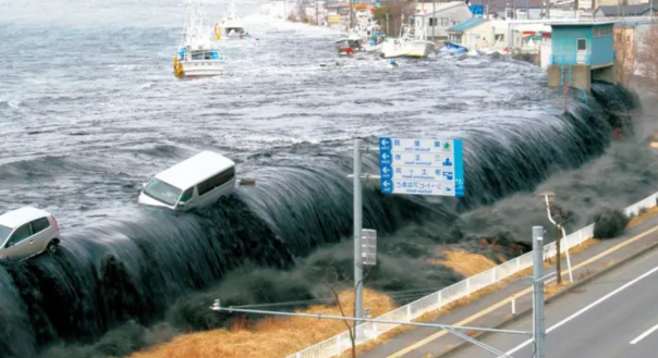
A Mega Tsunami Warning in this context means not just high waves, but a disaster capable of changing shorelines instantly, submerging cities, and destroying thousands of structures.
Scientific Findings Behind the Mega Tsunami Warning
Virginia Tech’s team ran thousands of computer simulations to predict the extent of flooding. Their findings revealed that existing hazard maps underestimate the true risk. Key highlights include:
- Sudden land subsidence of up to 6.5 feet along the coast.
- Tsunami waves potentially reaching 1,000 feet in height.
- Cities like Seattle, Portland, and Northern California towns at risk of complete submersion within minutes.
- Over 170,000 buildings destroyed and more than 30,000 possible fatalities.
- Economic damages estimated at over $81 billion.
Such statistics validate the current Mega Tsunami Warning, showing that preparation must extend beyond traditional disaster planning.
Which Areas Face the Highest Risk?
The areas most at risk from the Cascadia Subduction Zone include:
- Northern Oregon – Home to coastal towns with limited evacuation infrastructure.
- Southern Washington – Includes parts of Seattle’s metro region vulnerable to flooding.
- Northern California – Low-lying communities with dense populations.
- Alaska and Hawaii – Though further away, secondary tsunami impacts could affect these regions.
These regions are specifically highlighted in the Mega Tsunami Warning issued by researchers.
Why the Mega Tsunami Warning Matters Today
The urgency of the Mega Tsunami Warning lies in the fact that modern cities and populations are more vulnerable compared to 1700. Today’s coastal regions have millions of residents, advanced transportation networks, and energy infrastructure that could be wiped out in minutes.
Furthermore, global trade through West Coast ports would face massive disruption, impacting not just the U.S. but the international economy. The ripple effect could include supply chain breakdowns, food shortages, and long-term displacement of communities.
Precautionary Measures Against a Mega Tsunami
Given the gravity of the Mega Tsunami Warning, experts recommend several precautionary strategies:
1. Strengthening Early Warning Systems
Governments must invest in seismic sensors, tsunami buoys, and AI-driven monitoring systems to provide real-time alerts. Even a 10-minute warning can save thousands of lives.
2. Public Awareness Campaigns
Communities in high-risk areas need regular drills and education about evacuation routes. People must know the difference between a regular tsunami alert and a Mega Tsunami Warning.
3. Coastal Infrastructure Planning
- Construction of tsunami-resistant buildings.
- Elevated evacuation shelters.
- Relocation of critical services like hospitals and emergency centers to higher ground.
4. Emergency Evacuation Routes
Developing well-marked evacuation routes, free from congestion, is essential. Communities must prepare vertical evacuation structures where horizontal escape is not possible.
5. Household Preparedness Kits
Families should maintain emergency kits with food, water, medical supplies, radios, and important documents. During a Mega Tsunami Warning, survival often depends on immediate self-reliance.
6. Government and Policy-Level Planning
- Updating hazard maps based on new research.
- Mandatory insurance policies for at-risk properties.
- Coordination between state and federal disaster response agencies.
7. International Cooperation
Since tsunamis cross borders, countries along the Pacific must share data and collaborate on preparedness. Japan’s experience with the 2011 Tohoku tsunami provides valuable lessons for North America under a Mega Tsunami Warning.
Lessons from Past Tsunamis
- 2004 Indian Ocean Tsunami: Claimed over 230,000 lives across multiple countries due to poor preparedness.
- 2011 Japan Earthquake and Tsunami: Despite advanced technology, over 15,000 people died. Nuclear disasters like Fukushima highlighted additional risks.
These tragedies underline why a Mega Tsunami Warning for the Cascadia Subduction Zone cannot be ignored.
The Economic and Social Impact
If the CSZ ruptures, experts predict:
- Loss of power, water, and communication for months.
- Displacement of millions of residents.
- Severe impact on U.S. agriculture and exports.
- Long recovery timelines, possibly extending beyond a decade.
The Mega Tsunami Warning is not just about saving lives, but also protecting long-term national stabilityThe Cascadia Subduction Zone presents a very real threat that could trigger one of the most devastating natural disasters in U.S. history. With a 15% chance of a massive earthquake in the next 50 years, the Mega Tsunami Warning must be treated with urgency. Preparedness—ranging from individual household readiness to government-level evacuation planning—remains the only way to reduce casualties and economic loss.
Ignoring this Mega Tsunami Warning could mean repeating the mistakes of past disasters, but taking immediate action offers a path toward resilience and survival.
Also visit:- https://mineverse360.com/real-madrid-sack-xabi-alonso-after-super-cup-defeat/
4 thoughts on “Mega Tsunami Warning: Cascadia Subduction Zone Threat and Urgent Preparedness Needed”