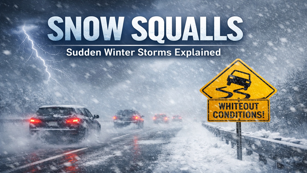
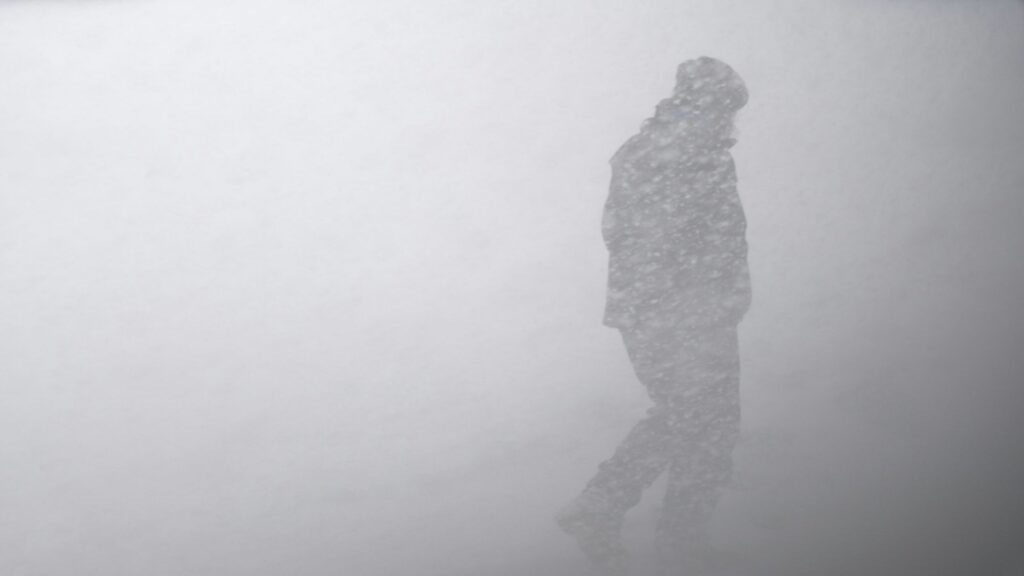
Snow squalls are brief, powerful bursts of heavy snow and strong wind. They often come on suddenly and last only 10–60 minutes. Despite minimal accumulation, a snow squall can quickly create a blinding whiteout and freezing roads in minutes. Unlike prolonged snowstorms or blizzards, squalls are localized in time and space. They usually form along cold fronts, much like thunderstorms form on warm afternoons. For example, the National Weather Service defines a snow squall as “a brief but intense period of heavy snow (up to 2 inches in 30 minutes), strong winds (30+ mph), and whiteout conditions (visibility <¼ mile)”. In everyday terms, imagine driving in clear conditions, seeing a dark cloud off ahead, and then suddenly entering a wall of snow and gusty wind. Visibility collapses and the road becomes slick almost instantly.

Snow squalls come in two main types. Frontal snow squalls are intense, narrow bands of convective snow that ride along a cold front. They behave like a wintertime squall line – moving fast and dumping heavy snow briefly. These frontal squalls are what usually trigger special “snow squall warnings” from weather services. The other type is lake-effect snow squalls, which occur when very cold air blows over relatively warm lake waters (common around the Great Lakes). Lake-effect squalls can also produce intense whiteouts and heavy snowfall in narrow corridors. In fact, very cold air over warm lakes can even lead to thundersnow – winter lightning – within snow squall bands. Overall, a squall (sometimes spelled snowsquall) is characterized by sudden strong winds, blowing snow, and near-zero visibility.
Snow squalls are often unexpected and dangerous. They can strike even when the sun is out and no larger storm is in progress. Because squalls move quickly, drivers have little time to prepare. For example, a typical scenario: you’re on a highway with dry pavement and clear skies, then you see a low gray “cloud” in the distance. You think it’s just snow flurries – but within minutes it becomes a whiteout. You can barely see the car ahead, and snow starts sticking on the road. In this moment, any sudden braking or a crash ahead can trigger multi-car pile-ups. Some historical snow squalls have caused hundreds of vehicle crashes. In one 2001 Pennsylvania squall, over 100 cars piled up on icy I-80, killing 8 people and injuring 45. Another squall in Massachusetts (2003) led to over 500 accidents in one afternoon. These events show that even low snowfall totals can be lethal when mixed with sudden ice and whiteout. Snow squalls can also trigger flash freezes: snow falling on warm road surfaces can first melt and then suddenly refreeze into black ice as temperatures plunge. In short, squalls create a sudden trifecta of whiteout visibility, slick roads, and surprise – a recipe for hazardous travel.
Snow squalls most often occur in cold seasons (typically November through March) and during the daytime. They are fast-moving because they often ride a strong cold front – the same kind that spawns thunderstorms in summer. Because of this, meteorologists use specialized forecast tools to spot squall potential. For example, the “WINDEX” (Wintertime INstability indEX) is a forecast index that identifies when cold air moving under unstable layers could ignite a squall along a frontal boundary. Modern weather models and radar data also help. Dual-polarization Doppler radars, for instance, can distinguish snow from rain and show wind patterns in fine detail. This lets forecasters see a sharp wind shift (the front) and pockets of very heavy snow on radar scans. Satellite and radar nowcasting systems allow operators to track developing squall bands in real time. Scientists have even developed specialized computer simulations (like NOAA’s snow-squall composite parameter) to predict squalls hours ahead. Despite these advances, squalls remain one of the trickiest hazards to forecast because of their small size and short life. That’s why the National Weather Service issues Snow Squall Warnings for very specific areas, much like a tornado or severe thunderstorm warning.
When a snow squall warning is issued, it often comes through as a smartphone alert. The advice is clear: Avoid or delay travel until the squall passes. If you must drive, slow down, turn on headlights and hazard lights, and keep extra distance from other cars. Avoid slamming on brakes; gentle braking is safer on slippery roads. If caught in a squall you cannot escape, stay in your lane and reduce speed. Carrying an emergency kit in winter (warm clothes, blankets, food, and water) is also wise. Remember: “There is no safe place on a highway during a snow squall,” as meteorologists warn.
Snow squalls can happen in many regions prone to cold air and moisture. In the U.S., they’re common in the Northeast, Midwest, and Great Lakes area. Canada’s winter fronts often produce squalls as well. Internationally, any place with cold fronts (like parts of northern Europe) can see similar mini-blizzards. Unlike major storms, squalls don’t usually last long enough or drop enough snow to trigger large storm warnings. Instead, they strike fast and leave quickly, which is why they used to be called “hidden” hazards. Advances like the Snow Squall Warning and impact-based forecasts have helped raise awareness. Uncommon facts: sometimes squalls are accompanied by thunder and lightning (especially lake-effect squalls). Also, special research shows thundersnow can be more common over great lakes and mountainous areas where squalls form. In the future, higher-resolution models and AI might improve minute-by-minute squall forecasts. For now, understanding the signs – a sudden sky darkening along a cold front – and heeding warnings can save lives.
Key Takeaways:
- A snow squall is a short, intense burst of heavy snow and wind causing a near-instant whiteout.
- Squalls form along cold fronts or from lake-effect bands, and often occur on clear days without large storms.
- They are extremely dangerous to drivers – roads can ice over in minutes, leading to multi-car wrecks.
- New “Snow Squall Warnings” and radar/model tools help meteorologists issue timely alerts.
- To stay safe: delay travel in a squall, or drive very cautiously with extra distance and no sudden stops.
Sources: Official weather services and research studies provide the definition and safety advice. Recent reporting and NOAA analyses give insight into forecasting, accidents, and new warning systems. Weather science resources explain radar and prediction techniques
1 thought on “Snow Squalls: Sudden Winter Storms Explained”